11/30/09

Making the greenway wildlife-friendly


Wildlife need places to drink (besides the Student Union)

Yesterday I was in the ravine looking for wildlife habitat. I found a possible den tree for Opossums, some other burrows in a streambank cut, and saw a hawk circling overhead. I wanted to share some thoughts about keeping the place a home for wildlife.

Above all, wildlife need variety.

  • In the water, they need pools, rapids, and slow-flowing areas.
  • On land, they need cut banks for burrows, along with thickets, piles of brush or wood, and a variety of vegetation.
  • In the canopy, they need a variety of trees including ones that produce nuts, and dead trees--hollow ones for dens and for woodpeckers.

Water adds variety essential to wildlife. Drawing by E. Buchbaum.

Trees alone don't attract a wide variety of wildlife, other than squirrels and birds. When you add the aquatic dimension--a stream with pools and rapids, and little "wetland" seeps, then there's a lot more variety of interesting critters.

The greenway also serves as a corridor for movement of wildlife, allowing them access to other wild areas that meet additional needs they have.

The problem with riprap and other potential solutions is that they homogenize the area, destroying the variety. Riprap isn't fundamentally hostile to wildlife, unless it eliminates the cut banks, the pools, the flowing water, and the living and dead trees. Unfortunately, riprap is bulky and uniform, and it tends to put the water out of sight.

However, I think it is possible to carefully design the greenway improvements so that the various needs of wildlife--eliminated on one place by riprap--are put back in another place. This is called "remediation."   We need to see a new plan for the greenway with "remediation" for wildlife added.  Option 4.

One problem with the ravine may be that it's a bit dry on the slopes during the summer. Probably it could support a greater variety of vegetation if we could create some "seeps" of the kind you see in natural ravines. Rain barrels, feeding water down to the ravine via "soaker hoses," might do the trick.  Could the city share the cost of rain barrels and hoses?

What about mosquitoes?

One reader asked: "What risk is there of increased mosquitoes if standing water is significantly increased?"

There is a risk of increased mosquitoes in certain kinds of standing water pools.  Normally, fish, tadpoles and other small critters eat the mosquito larvae if the stream has enough water. Probably we don't have those critters. But if there's a storm, the rush of stormwater will flush the mosquito larvae away. So, if the pool flushes or dries up in less than 2-3 weeks, no mosquitoes. That's why mosquitoes are so variable from year to year--they need just the right conditions.

Riprap doesn't eliminate the risk of mosquitoes. Water could still pool, but out of sight in the cavities below the rocks. When this happens, it's hard for the City to treat the invisible pools.

Monitoring for mosquitoes in the little pools of the greenway would make an ideal project for a middle school student. They keep track of how long the pools have existed--and use a little dipper to strain out larvae, to see if any are present.

A learning opportunity! Turn a liability into an asset. But if we eliminate all the pools, the opportunity is gone.

Yes, even mosquitoes are wildlife.

Erosion--a watershed approach

I was hoping erosion in the ravine would be confined to a few places, so "spot fixes" would solve the problem.  But when I inspected it yesterday, I found erosion to be widespread.


Cut banks--where most of the erosion occurs.  They have to be fixed.

Erosion is a problem not so much for residents, as for the lake.  A delta has been forming for some years in University Bay, where our stormwater goes.  Erosion in the ravine needs to be fixed, in part with a watershed approach.

A watershed approach

Erosion happens in the ravine when there's a big flood.  When the creek gets really full, as it may during a cloudburst or spring runoff, rushing water cuts into the banks.  Truckloads of soil head for University Bay.  These floods are greatly aggravated by pavement all over the neighborhood, so improvements to the neighborhood can reduce the need for desctructive improvements in the ravine.

Slowing the rush of stormwater involves more than just building rain gardens.  You need basins to store the runoff from a cloudburst for a couple of days.  Nowadays, basins are a requirement for new neighborhoods.  But in a developed neighborhood like Sunset Village--where there's no space--what do you do?

The answer is, you get creative!  There must be hundreds a little places in the steets, terraces, back yards, and parks, where a tiny landscaping adjustment would cause floodwaters to pool.  After a day or so, the water would be gone and no harm done.  I have such a spot on my front lawn.  No problem!

I'm sure our children would be thrilled to become "deputy stormwater engineers," who would go about the neighborhood during the rain, looking for places to build "stormwater pools."  Classes or scout groups could coordinate their efforts, putting the little pools on maps, keeping track of progress.   Let's give our kids a reason to turn off the TV and go outside to do something constructive.


"Junior stormwater engineers" receiving encouragement.  Hammersley Ave. between Alden and Standish. Note how water pools here naturally.

And inside the ravine...

...the soil is lost from the bank cuts. And the ravine cuts a little deeper every year.   Besides these problems with the channel, the slopes of the ravine "slump" or creep downward towards the cannel.  So where slopes are steeper, they may need to be shored up with boulders or terraces.


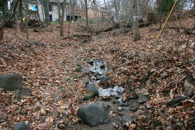
Central portion of ravine--natural curves and eroding banks.

People are going to walk in the ravine, if only to adjust the soaker hoses, pull garlic mustard, or plant some ferns.  Their footsteps are going to add to the downhill creep of the soil.   So it would be helpful if some very inconspicuous pathways are planned--just flat pieces of limestone.  If the city provides these, residents could install them where needed or desired.  If we create wet seeps, such stepping stones will become more necessary.

Different zones of the greenway

The public greenway varies in width. 


The eastern part is less steep--the stream forms natural pools there. These pools are essential for wildlife.

Downstream, where it's more narrow, it's going to be harder to save the trees, so heroic measures to reduce disturbance are needed there.


At the bottom (western end), some nice trees are growing right in the channel.  Here the channel is naturally riprapped, but still probably needs improvement.

There are lots of trees, so leaves accumulate in the greenway and wash downstream.  Can some kind of compact filter be build at the west end of the ravine so leaves can be periodically collected and kept out of the lake?


So our new Option 4 needs to take full account of variations in the greenway.

11/29/09

Not enough options

So far, the City has given us three options
  • Option 1, with the stream buried and a road on top, was the old plan neighbors soundly rejected--because of the road and loss of 65 trees.
  • Option 2 is a little better because it leaves the stream open and eliminates the road, but it cuts 66 trees, and fills the ravine with stone rubble called riprap.  Riprap is not friendly to children or wildlife.
  • Option 3 leaves the stream relatively natural and cuts few trees, but doesn't solve erosion or all of the sewer problems.  The erosion is bad and needs to be fixed for health of the lakes.  People want the sewers to work.
So if we are limited to the current choices, most people are going to choose Option 2.  It's a foregone conclusion.  People who love wildlife and want to save most of the trees have lost out.  They didn't have a real choice.  With the riprap in Option 2, you won't see the water except during heavy storms and spring runoff.

What we need from City Engineering is a real choice--an Option 4.  Something that leaves the ravine more natural, with some pools of water, yet still solves the problems of erosion and sewage. 

Wildlife lost out, because they weren't among the 5 objectives listed for the project:
  • Address erosion in the greenway
  • Address aging sanitary sewer
  • Allow for maintenance of sanitary sewer
  • Minimize land disturbance
  • Minimize tree loss
I hope to see "retain wildlife habitat" and "maintain appearance of natural stream" added to the objectives.  Perhaps also "develop outdoor laboratory for local elementary schools."  A place where they could plant woodland flowers, help control garlic mustard, or observe plants emerge in the spring.

"Option 4" should also include long-term plans for reducing runoff from the neighborhood.  For example, rain gardens to handle runoff from streets, and a hundred tiny dams to hold the water back during a cloudburst.  With less stormwater runoff, designs for the ravine can be more modest--less destructive and less expensive.

What's the hurry?
There's time to develop Option 4.  If there aren't any suitable techniques to stop erosion, then let's design new ones that can be installed without destroying the ravine.  There's plenty of talent in Madison. 

Wildlife seen in or near the ravine in recent years
Coyote
Fox
'Possum (probably had young this year in dead tree 190)
Raccoons
Deer
Wild turkey
Hawk (circling overhead and calling today)


Nature--not always pretty, but always educational for kids. Young 'possum found dead in ravine today.


'Possum carcass in foreground, probable den tree #190 in rear.

11/28/09

A question of community standards

At the Sunset Village meeting last week, some neighbors wanted to make sure that the City was going to follow "best practices" when repairing our greenway.

But after thinking about this more, I'd like to pose a question:  Sure, we want to employ best practices, but best... for what?  Practices are a means to an end.  What is our end?

When Madison was a young, people dumped sewage into the gutter or their back yards.  This was the current "best practice."  As the population grew, people got the bright idea of hooking up a number of houses in a neighborhood, and running a sewage pipe into Lake Mendota.  This was now the "best practice"--no more smelly sewage in the gutters!  It wasn't long before they noticed unfortunate changes in the lakes, and so practices had to change.  All the sewage pipes going to the lake were hooked to a central sewage plant.  This wasn't convenient, but it was necessary to avoid unpleasant consequences. 

Now that we've got sewage under control, the focus shifts to stormwater.  As the city grows, what's necessary to avoid those unpleasant consequences?  Or better, what do we need to do to leave a cleaner city and lakes to our children?

I think we've got good people in our Engineering Department, and they'll to the right thing if we send them a clear message--a message about our standards for the 21st century.

So Hillcrest-Upland neighbors, Sunset Village, and even the whole city needs to decide:
  1. Is the ravine just a stormwater channel and a low place to run sewage pipes?
  2. Is the ravine a sort of recreational greenway with places for children to play, adding natural values of shade, wildlife, and water sounds for residents with adjacent properties?
  3. Is it a wildlife refuge and corridor, where we hope to see foxes, racoons, great horned owls, and turkeys?
The City's "Option 1" for the greenway assumes the greenway is just a stormwater and sewer channel.  They didn't know we had something else in mind.  It was a problem of communication.  Perhaps too, we hadn't made up our minds.

I'm proposing that plans for the greenway have wider significance.  What we do to repair the greenway is going to set the standards and tone for other projects.  It could be a valuable pilot project, where the City could test new techniques for restoration, just as they have tested rain gardens.

What goes into the storm sewer--goes into the lakes.  How we treat our stormwater reflects how we care about our lakes.  Riprap (Option 2) is stone rubble.  Dumping rubble into the ravine is like dumping it into our lakes. 

Riprap is a biological desert.  Yes, it stops erosion.  Also, it pretty well stops wildlife.  Is that the future we want for our lakes?  

I hope instead that we begin to treat our streams and stormwater channels with more respect--so they can become living systems again--places that filter the rainwater, let it sink into the ground, and deliver it to the lake cleaner than it was when leaving your yard or sidewalk.

11/25/09

Not all riprap is created equal

The Glen Oak Hills stream near Oakwood Village is an example of what an undisturbed stream looks like; it also shows 40-year-old riprap.  The upstream portion is natural, while the downstream portion has riprap on the left bank.  The stretch of riprap looks good, because it has large stones, uniform in size, and carefully stacked.  So whether riprap looks good depends on the craftsmanship and design.  It can be done very badly, or skillfully.

Residents seem in agreement that the stream should be open.  But will it really be "open," if riprap is used?  A small stream's water will disappear if riprap is laid thickly on the streambed.   If our stream is riprapped, you won't see any water, except during heavy storms or spring runoff.

I support Option 3 (keep streambed mostly natural) because:
  • Far fewer trees are cut, and residents want to save the trees.
  • Water will still be visible in pools.  With the other options, water pools will disappear, and wildlife will not be able to drink. Riprap is a desert for wildlife. Residents value the wildlife. 
  • Option 3 is the most natural and the most pleasing. Stormwater greenways have great potential as wildlife refuges, quiet places for human enjoyment, and for education of schoolchildren.  But they can never realize this potential if we destroy them.
Those are my conclusions based on a rainy day of scouting.  Below are my observations.  I'll take you there.  You can click on a photo to enlarge it.

Glen Oak Hills Neighborhood stream

Thanks to Kathy McElroy for finding a stream in the Glen Oak Hills neighborhood that's a good example for us to study.  It's located on Masthead Dr. near its junction with Island Dr.  If you stand on Masthead and look West, upstream is on you left.  Upstream, the stream is natural, no riprap. There has been little or no disturbance of the streambed.  The boulders are all rounded from the glacier.  Many of them are granite. 
Upstream portion--natural streambed, no riprap


Upstream--we can tell this isn't riprap because many large boulders are granite, and large trees come to the very edge of the stream.


This part of the stream looks good, so it's important that readers realize that it hasn't been riprapped.  Riprap was not needed, because the stream is not incised into a ravine.


Downstream from Masthead Dr., the stream now runs in a ravine, so the bank needed reinforcement. In the photo above (W bank,downstream), you can see a steep bank of riprap limestone. (The riprap blocks have a greenish-yellow or ochre color.)

Above: As you look further downstream, the riprap has ended.  It has given way to the natural, rounded boulders you see here--a natural streambed.

The riprapped bank on the downstream west side, now about 40 years old, looks good for three reasons:
  • The stones have weathered some, and are covered with moss.
  • The stones are large, averaging about 2 feet (some 3 ft)--with relatively uniform sizes
  • The stones are carefully stacked
Flowing water is still visible in the riprapped section because either the riprap was not thickly laid, or sediment has filled in the spaces between rocks--or it's possible that no riprap was laid in the streambed.  This stream also has a lot more water than our creek.


Ravines between Glenway Golf Course and Bikeway

The straight ditch of riprap running parallel to the bikeway was finished a year ago. 


No water visible here during a rainstorm. A biological desert.

There are many large blocks, but here's how it differs from the riprap at Glen Oaks Stream.  It...
  • Has some large blocks but a lot more small stones.  Sizes not uniform.
  • Was not laid carefully--just jumbled in place--a pile of rubble.
  • Was laid more thickly.
This stretch of riprap is ugly because of poor design and poor execution.  Basically, overkill.

But the key point I want to make is--the water goes under the stones!  The water flows through spaces below the thick layer of rocks.  I visited during the rain, and I saw no water flowing anywhere on riprap, except for...

Wildlife needs variety plus pools for drinking.


...this spot.  And the water pools here only because the outlet in the rear forms a dam.


Riprap, with unstable blocks and sharp edges, is more hazardous for children.


This section of riprap along the bikeway shows how haphazardly the stones wrere placed. Lack of uniformity in size makes it worse.


Metal Rock vanes

Option 3 for our greenway suggests 3 metal rock   vanes, or dams, at the E end.   Imagine these metal dams as rock dams in our greenway:
Below the Glenway Golf Course, in a ravine leading to the bikeway, riprap and metal dams were constructed about 12 years ago.  The goal was to control erosion.  The riprap here looks better because it was not laid so thickly.  Because it's shady, moss has had a chance to grow on the stones.  Update: This might be the best example of what our greenway might look like under Option 2: DRY.

It's important to note: during the rain, NO WATER WAS VISIBLE.

Pools for wildlife

Wildlife need places to drink and variety.  Pools are habitat for plants and aquatic insects--they attract small animals, which attract larger animals.

Our stream is starved for water because there aren't enough places for water to sink in.  If we can create enough rain gardens upstream, there is hope for a natural stream, and a chance to show our kids how to restore nature. 

But for now, the stream is dry most of the time.  But it's possible even now to restore some small pools.  If shallow basins are scooped out, and a waterproof barrier is placed under the little basin, water will remain for a few days, attracting more wildlife.

An ideal place for pools would be above or below each of the three dams suggested for Option 3.  Imagine a little waterfall, rushing into a pool!

At the International Crane Foundation, a wetland for the Whooping Crane exhibit was created in this way, even though the "wetland" was far above the water table.

For this project, we have a chance to think about how to realize the wonderful potential of our stormwater greenways.  It's a slow process, but a pilot project here would be good for the whole city.

What Option 1 (bury stream) will look like


This is Westmorland Stream, just below Tokay Blvd., buried long ago.  Looking toward bikeway.
Because the ravine is partially filled to bury the pipe, it is shallower than before.

For a slide show of these photos and more, click here.  Move cursor off screen to see photos full screen.

11/24/09

Plans for the greenway are now online

City Engineering has proposed three alternate plans for restoring the greenway, so citizens can be informed before the meeting scheduled for Monday, Nov. 30 at 6:30 pm, at Covenant Presbyterian Church.  Go here, and look for the link to Hillcrest/Upland on the top right.

The three options are:
  • Bury the stream and replace the sewer--apparently the original plan.
  • Leave stream on surface, but reinforce the bank with riprap, and replace the sewer.
  • Leave the streambank as is, with possible addition of three small metal rock dams ("vanes") at the upsgtream end to control erosion.  Sewer not replaced--only relined.
Impact of the plans on trees

Unanswered was whether work on the lateral sewage lines would require the cutting of any additional trees.  trees.    Options 1 and 2 say tree "clearing limits not shown in vicinity of laterals."  Chris Schmidt tells me that all the trees that need to be cut for lateral sewage lines are included in the X count. There are 21 lateral sewer lines, so it seems possible that additional trees might be cut.
  • Option 1 (buried stream) involves cutting down at least 55 living trees and 11 dead trees.
  • Option 2 (riprap open stream) involves cutting down at least 57 living trees and 11 dead trees.
  • Option 3 (leave stream mostly as is) involves cutting only 6 living trees and 1 dead tree.
My first look suggests we should back the third option--but I need to do more study.  Far fewer trees are cut with the third option, and the stream will look more natural.  Without riprap, water will  be visible more often.   I suspect Option 3 will save a lot of money--could some of the savings be applied to some plantings or terracing (stone walls to stop slumping in the steepest parts) ?

Update as of 11/29: I don't support any of the current options.  I'm closest to supporting Option 3, but it doesn't address the erosion.  We need more study, and a new option, Option 4.

I suspect that Option 2  will require larger equipment for both tree cutting and riprapping.   With Option 2, corners are cut so the stream becomes more straight.

Questions about the third option
  • What to the metal rock vanes (dams) do?  What do they look like? 
  • Would the vanes control all the erosion?  What about existing bank cuts?
  • Would any trees need to be cut for lateral sewage lines?  Update: Chris Schmidt says that trees that have to be cut for laterals are already included in the diagrams.
  • What size equipment is needed to repair the sewage line, and how would it get into the ravine?
  • Would any funds be included for terracing or naturescaping to restore damage that does occur
  • Has the sewer frozen so far?  If not, there's no reason to believe it will freeze in Option 3.

"Sewers at Capacity, Waste Poisons Waterways"


The Harlem River, on the east side of Manhattan, often receives sewage overflows during rain storms.  Viewed from a kayak.


On Monday, there was an important article in the NY Times about water pollution from sewage overflows. Although the focus was on New York and  the national scene, there were some tidbits of relevance to Madison:

As global warming increases the severity of storms, and as urban areas grow, stormwater problems are going to become more serious everywhere.  It's policy in Madison to increase density in neighborhoods.  That means we have to improve absorption of rainwater into the ground, just to keep up with the growth.

"Philadelphia has announced it will spend $1.6 billion over 20 years to build rain gardens and sidewalks of porous pavement and to plant thousands of trees."  Why trees?  These and other plants pull moisture out of the soil and put it back in the air, thereby reducing the load on stormwater systems.

A report in Science this week says that, more and more, we have to pay attention to what is going on under the ground, in terms of water quality and polllution movement.  The more crowded the planet, the more critical the underground resource becomes.   Because changes are slower underground, and because what happens there is invisible, we have to be vigilant--or we'll degrade our living "basement" before we know it.

In summary, rain gardens are a growing trend, nationwide.  Our little stream in Sunset Village can become an aid for teaching children about groundwater resources.  We could drill shallow wells to show schoolchildren our progress in recharging the groundwater.  Let's show them--there's more to water than turning on the tap.
*   *   *
Link to report about sewage overflows in Wisconsin.  You can use this as a primer about sewer construction and issues.

11/20/09

"Wolf or wolf hybrid" captured near greenway

Residents who love wildlife in the greenway were surprised when a wolf or hybrid was captured nearby on Thursday.

But don't worry--there's no evidence it has a den there.  Instead, it lives indoors just a few houses away, in the 200 block of Falles Ct.  The pet belongs to Greg Weber.

The pet was captured in the 500 block of nearby Charles Lane after escaping from Greg Weber's truck.

The animal control office and police were flooded with calls reporting a wolf.  Some people said it was howling.  When captured, the animal "seemed shy and responded to treats."  It wasn't aggressive.

Keeping a wolf or wolf hybrid is illegal in Madison, but the animal won't be tested, because it's complicated and expensive.

I guess this just confirms--that people living around the greenway... love wildlife. 

Source

11/16/09

Friends groups around Lake Mendota

Our stream empties into Lake Mendota at University Bay.  All around the lake, groups or citizens are starting up to help protect the lakes.  Here are a few examples:

Token Creek Watershed Association is a resident-driven effort formed in March 1997 to seek collaborative ways of preserving and/or improving watershed conditions so that involved residents can proudly pass on the stewardship of the area to their children and grandchildren.

The Friends of Cherokee Marsh and Upper Yahara Watershed formed in 2006 to appreciate, protect, and help restore the special natural features of this unique ecological treasure.

The Friends of Kettle Ponds is a non-profit (501-(c)-3) group, formed in 2002 with the goal of preserving and improving the quality of the kettle ponds and surrounding wetlands in Middleton and western Madison. We work closely with the DNR. As a non-profit partner to the City we can obtain environmental grants and provide volunteer labor to enable the City to implement improvements it could not otherwise afford.

The Friends of Pheasant Branch organized in June 1995 to “restore, preserve and promote the value of conservancy lands and other habitats in the Pheasant Branch watershed for today and tomorrow.”
They face the challenge of preserving and restoring wetlands, prairie and savanna in a 540-acre conservancy in an urban area. They are working to reduce the amount of polluted runoff flowing to Pheasant Branch Creek, and to protect the recharge area for a major spring complex in the Pheasant Branch Conservancy. They seek to educate local residents of all ages about the ecology of the Pheasant Branch Conservancy and promote an understanding of its value to the community.

Friends of Stricker's Pond work to preserve the wetlands and wildlife area of Stricker's Pond, a
conservancy located on the border of Madison and Middleton.

Friends of Lake Wingra.  Good news!  Carp removal has resulted in much clearer water in the lake!

This info is quoted from the Dane County State of the Waters Report.

11/13/09

Mayor Dave sighted in greenway

About Wednesday of last week in the morning, one of our neighbors was walking down Owen Drive to work.  As he passed the greenway, he saw a city car pull up, and three men got out.  He hailed them, and asked if they were "going to cut our beautifuil trees."

It was then that our neighbor noticed that Mayor Dave Cieslewicz was one of the three men.   They shook hands, and then our neighbor asked again if Mayor Dave was going to cut our beautiful trees.  The Mayor mumbled something non-commital, as you might expect.  And then everyone went about their morning duties.

But here's the point: We have raised enough noise, and enough good points, that our issue has gone to the top!  The Mayor has taken note!

Stay tuned for our next posting: "Elvis sighted in greenway."

11/11/09

Neighborhood Meeting discusses Greenway

On Nov. 11, the Sunset Village Neighborhood Association met at Sequoia Library, led by President Janice Antoniewicz-Werner.  About 40 minutes of the hour-long meeting were devoted to the greenway issue.  About 19 people attended.

Marsha Siik, whose property abuts the greenway, spoke about how neighbors had spontaneously gathered together to fight misguided city plans, and where the plans stand now. 

David Thompson spoke about trends in stormwater management, hopes to "naturescape" the creek, and the need for wider community involvement. 

Questions and discussion followed.  One person made the point that we should find out what "best practices" might apply to this situation, and hold the city to such practices.  There was also discussion about looking for professors who might have expertise, and looking for classes to become involved in studying our situation.  Students going out in the rain could find the best places for rain gardens, and look for other ways to slow the runoff of stormwater.

"Naturescaping" for our stream

There seems to be a rough consensus among residents near the stream that any erosion control construction should leave the stream looking as natural as possible.  Let's call this "naturescaping." 


"Riprap," which is the dumping of stone rubble into a trough gouged by heavy equipment, does not fit this definition. (Click to enlarge)


I have been looking on the internet to find examples.

Here's one, my best example--click to view.  Concrete has been used to line a streambed, with a rough appearance, and following the curves of the stream.  Next, rounded stones have been dumped into the stream to give it a more natural appearance.  Our stream might require some metal barriers to prevent the stones from washing downstream in a big flood.  The metal barriers, little dams really, would also allow sand to collect for children to play in, and provide little pools where animals could drink.  They would create a lovely rushing sound when water was flowing.

This photo, from Maryland, is for a stream (or artificial garden) with much more water than ours.  But it's inspirational, shows what the potential is.

Here are two examples from Ontario, near Guelph.  Again, perhaps a bit bigger than our stream, but very inspirational.  Both are disturbed--but it's hard to tell if stream is running over rock or concrete. Photo 1 Photo 2

Here's an example of a small channel lined with riprap. This shows that riprap can follow a curved path.  But note that the water is running mostly underground, through the rocks.

Stream corridor restoration--a trend
"Today, interest in restoring stream corridors is expanding nationally and internationally.... Stream corridors are increasingly recognized as critical ecosystems supporting interdependent uses and values."  Source


Here's an example of a completely restored small stream--restored after it was obliterated by a landslide. 
Photo thanks to Fish & Wildlife Associates

Stay tuned!  I'll add more examples as I find them.

11/4/09

Update on Greenway Plans--by Chris Schmidt

Meeting tentatively scheduled
We've reserved Covenant Presbyterian Church on Nov 30 at 7pm. It is a bigger and less personal space than I wanted for this meeting and later in the month than anyone would like, but there is very little meeting space available in the area in November and December. I would appreciate it if you would circulate the date and time - if that doesn't work for people we can find another date, but it will be later into December. The mailed notice will be going out about two weeks in advance of the meeting.

Progress so far
I've been meeting with Engineering to talk about the alternatives. As you may know, the "access road" is no longer on the table. The goal then is threefold:
  • repair the sewer,
  • protect existing, healthy trees, and
  • limit erosion as much as possible.
The concepts that are being readied minimize disturbance as much as possible, and we'll be able to talk about which trees would be impacted with a good level of detail at the meeting. The meeting will have depictions of the impact of sewer replacement versus lining, as well as looking at how to control the water flow. We'll also talk about whether to keep the water running basically where it is now or making some realignments.

Engineering will be posting concept drawings online in advance of the meeting, so you don't have to just rely on this text description.